
Romfart
Planet Labs (PL): Den skalerbare virksomheten innen jordobservasjon

 Legg til Securities.io blant dine foretrukne kilder på Google

Allseende øyne: Hvorfor jordobservasjon blomstrer
Rom- og satellittindustrien gjennomgår en revolusjon, med selskaper som Rocket Lab (RKLB ) og Intuitive Machines (LUNR ) som går aggressivt inn i markedet. Det betyr ikke at etablerte aktører i sektoren har mistet betydning eller ikke kan holde tritt.
Tradisjonelt har ikke-militær romvirksomhet vært konsentrert rundt satellitter for både telekommunikasjon og jordobservasjon.
Evnen til å observere jorden fra verdensrommet har blitt stadig bedre de siste tiårene, etter hvert som elektroniske og optiske komponenter har blitt mer avanserte og gitt et mer detaljert og sammensatt bilde av jordoverflaten.
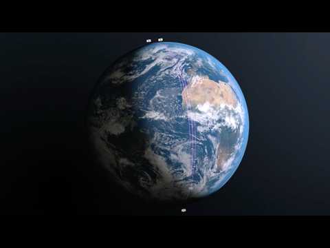
Satellittindustrien har også nytt godt av raskt fallende kostnader for oppskyting til bane og stadig større bæreraketter. Dermed kan man i dag skyte opp kraftigere og mer komplekse satellitter som ville vært helt umulige for bare fem år siden.
Samtidig må jordobservasjon leveres i en brukervennlig form, siden de fleste brukerne ikke er romeksperter, men bønder, byggefirmaer, offentlig ansatte og andre faggrupper.
Dette skaper et marked for selskaper som både kan produsere jordbilder av høy kvalitet og levere dem i kostnadseffektive pakker til sluttbrukerne. Planet Labs er en ledende aktør i dette markedet.
PL Prisdiagram
Planet Labs Oversikt
Planet Labs eier en flåte på rundt 200 jordobservasjonssatellitter, den største i historien, som avbilder hele jordens landareal hver dag.
Selskapet ble grunnlagt i 2010 og vokste gjennom en rekke oppkjøp og oppskytinger av nye satellittkonstellasjoner. Aksjen ble børsnotert i 2021. Planet Labs driver totalt fem ulike satellittkonstellasjoner, hver med sin egen spesialisering.

Kilde: Planet Labs
- PlanetScope: En konstellasjon av små CubeSat-satellitter som måler 10 cm × 10 cm × 30 cm og går i en relativt lav bane (525 km eller 326 miles over jorden).
- Hver av satellittene er fokusert på én type sensor, og det syntetiske bildet av hele konstellasjonen kan brukes til å lage et høydefinisjonsbilde av et stort segment av jorden.
- Tanager: En konstellasjon som bruker hyperspektrale bildesatellitter i verdensklasse for å oppdage metanutslipp med 3-6x mer sensitivitet enn sammenlignbare rombaserte systemer, med en 30m oppløsning.
- Pelican: En neste‑generasjons konstellasjon som sikter mot 30–50 cm oppløsning av bilder over synlige og nær‑infrarøde bølgelengder.
- SkySat: En konstellasjon som kan fokusere på etterspørsel på spesifikke steder på planeten, med 50cm per pixel oppløsning, som kan ta opp videoklipp på opptil 90 sekunder med 30 bilder per sekund.
- Owl: En planlagt 40‑satellitt konstellasjon fokusert på overvåkning, med mål om nesten daglig 1‑meter bilde når fullt utplassert. Første oppskyting er foreløpig planlagt til sent 2026.
Sammen gjør disse konstellasjonene at Planet Labs har den rette typen satellitt klar for enhver observasjonsoppgave en av deres kunder kan ha. Dette betyr også at selskapets kunder først kan identifisere et element av interesse med én konstellasjon, før de går dypere med en annen.
Mer enn bare bilder: Hyperspektral & Analyse
Bildene fra Planet Labs’ satellitter har ikke bare høy oppløsning; de inkluderer også hyperspektrale data (synlig, infrarødt og ultrafiolett lys). Dermed kan de brukes både til å se på landområder og til å analysere dem nærmere.
Bildene kan for eksempel fastslå jordfuktighet, metanutslipp eller aktivitet under vann.

Kilde: Planet Labs
En stor database med observasjoner over lang tid kan også gi tilleggsinformasjon. Offentlige og militære institusjoner kan følge byggeprosjekter i andre land, mens geologer og byggefirmaer kan vurdere stabiliteten i en fjellside før de starter et stort infrastrukturprosjekt.
Regelmessig produksjon av nye bilder gjør dessuten at endringer kan oppdages og analyseres svært raskt.
Det som gjør Planet unikt for oss er revisittfrekvensen med PlanetScope … når en hendelse har skjedd, ofte uten varsel, vet vi at dataene er blitt fanget.
Louise Jones – Leder for etterretning hos McKenzie Intelligence Services
Applikasjoner
De mulige bruksområdene for satellittbildene til Planet Labs er svært brede og dekker mange sektorer, ettersom de samme satellittene kan brukes til forskjellige formål.
Landbruk
Planet Labs’ tette satellittkonstellasjon besøker det samme området daglig og muliggjør kontinuerlig overvåking av jorder og gårdsbruk. Dette gir verdifulle data i alle stadier av planteproduksjonen.
Dataene kan for eksempel brukes til å finne beste såmetode, hvor det trengs vanning, og hvilke næringsstoffer en bestemt avling eller del av et jorde mangler.
De kan også oppdage spredning av sykdommer eller skadedyr og optimalisere behandlingen for å begrense skadevirkningene.
Selskapet har også et omfattende arkiv med 1 300 lagrede bilder for hvert acre på jorden. Bildene kan integreres i samme programvare som feltdata, for eksempel jordprøver eller observasjoner på stedet.

Kilde: Planet Labs
Kombinasjonen av alle disse dataene og historikken fra tidligere år kan gi svært presise anslag for fremtidige avlinger og produksjonsmengder, samtidig som beste praksis optimaliseres.
Skogbruk
Dagens satellitter er kraftige nok til ikke bare å hjelpe med kartlegging og planlegging av tømmerhogst, men også til å beregne stående tømmerbeholdning og kapasitet i ulike områder. Arkivdata kan dessuten vurdere tidligere vekstrate og skogens modenhet.
Det finnes ikke noe annet sammenlignbart kommersielt system som kombinerer registrering av store områder med høy romlig og tidsmessig oppløsning.
Petr Lukeš – Fjernmålingsspesialist, Czech Republic Forest Management Institute (UHUL)
Et annet bruksområde i skogbruket er rask vurdering av konsekvensene av katastrofer som skogbranner eller flom. Spredning av sykdommer og skadedyr som dreper trær kan også vurderes fra verdensrommet, både av skogselskapet og relevante offentlige myndigheter.
Satellitter kan også avsløre ulovlig hogst i avsidesliggende områder, for eksempel avskoging i Amazonas eller Indonesia.
Planet-bilder kan brukes til å oppdage og kartlegge avskogingshendelser på mer enn ett hektar. Resultatene viser at endringene som avskoging forårsaker, kan trekkes ut automatisk med høy nøyaktighet.
Infrastruktur
For store infrastrukturprosjekter kan det være vanskelig å få et klart helhetsbilde, særlig når de bygger på mangelfulle analyser på stedet eller gjennomføres i avsidesliggende områder.
Planet Labs-satellitter kan redusere mange utfordringer knyttet til bygging og forvaltning av infrastruktur:
- Fjernvisualisering fra satellitt av skader, forringelse og korrosjon.
- Analyser foreslåtte steder for fremtidige infrastrukturprosjekter, planlegg byggingen, overvåk prosjektutviklingen og forutse forsinkelser.
- Oppdag inntrengning og overvåk rett til vei.
- Kartlegg miljøpåvirkning.
Vitenskapsprogrammer & Bærekraft
Vitenskapelig analyse bygger på nøyaktige data. Dessverre har de fleste forskningsprogrammer svært begrensede budsjetter og lite personell til feltarbeid, analyser på stedet og andre aktiviteter.
Derfor kan mer enn 20 000 forskere i over 100 land bruke Planet Labs-bilder til å avhjelpe problemet, og mer enn 2 000 vitenskapelige publikasjoner har benyttet selskapets bilder.

Kilde: Planet Labs
Mange forskningsprogrammer får tilgang til Planet Labs-bilder gjennom støtteordninger organisert av NASA, ESA (Den europeiske romfartsorganisasjonen) og andre internasjonale forskningsorganisasjoner.
Planet Labs-data kan også overvåke en rekke bærekraftsindikatorer, fra bærekraftig skogbruk og metanutslipp til biologisk mangfold og karbonopptak.

Kilde: Planet Labs
Forsvar & Etterretning
Militære og etterretningstjenester har naturligvis egne hemmelige spionsatellittprogrammer. Fordi systemene ikke kan observere alt samtidig, eller fordi myndighetene vil holde enkelte kapasiteter skjult, bruker de også kommersielle leverandører som gir mer stabil og omfattende dekning av jorden.
Planet Labs’ globale overvåkingstjeneste kan oppdage endringer nær sanntid, forkorte responstiden og integrere flere datakilder for global situasjonsforståelse.
Den kan for eksempel overvåke byggingen av atomrakettsiloer i Kina.
Den havrettede løsningen Maritime Domain Awareness overvåker havner, vannveier og strategiske havområder og bruker et omfattende arkiv med proprietære datasett som går tilbake til 2009.

Kilde: Planet Labs
Den samme overvåkingen kan brukes til økonomisk analyse ved å måle havneaktivitet, skipstrafikk og lignende.
«Planets dokumenterte evne til å gi umiddelbare svar på kritiske spørsmål om fiendtlige styrkers plassering, handlinger og hensikter ga styrkene våre en utnyttbar fordel over fienden.»
Representant for det amerikanske militæret
Forsikring
Data om tørke, katastrofer og infrastruktur er svært verdifulle for forsikringsselskaper. Ved å bruke Planet Labs-bilder kan et forsikringsselskap forutsi risiko, utbetalinger og fremtidige kostnader for avtalene sine mer nøyaktig.
Planet Labs tilbyr også forsikringsselskaper automatisk endringsregistrering og varsling samt mulighet for 5–7 besøk per dag — den høyeste kommersielt tilgjengelige frekvensen — til sanntidsovervåking.
Transparent prising & skalerbar forretningsmodell
Selskapet har transparent prising, med ulike abonnementer avhengig av hvilke regioner som dekkes og hvor mange kvadratkilometer kundene trenger.
Dette gjør at bedrifter kan begynne å bruke Planet Labs-data i liten skala og gradvis øke dataforbruket etter hvert som satellittbilder integreres i arbeidsprosessene.

Kilde: Planet Labs
90 % av inntektene er gjentakende og kommer fra års- eller flerårskontrakter, noe som gir Planet Labs svært forutsigbare kontantstrømmer.
Kostnadene for satellittkonstellasjonene påløper i hovedsak på forhånd, noe som gjør forretningsmodellen skalerbar. Kostnaden ved hver ekstra kunde er svært lav og bidrar til å fordele satellittkostnadene på flere abonnementer.
Sveip for å rulle →
| Selskap | Primær styrke | Oppløsning | Revisittfrekvens | Viktige kunder |
|---|---|---|---|---|
| Planet Labs | Daglig global dekning, hyperspektrale data | 30–50 cm (Pelican) | Daglig (opptil 5–7× i oppdragsmodus) | Forsvar, landbruk, forsikring |
| Maxar | Bilder med ultrahøy oppløsning | 30 cm | Daglig til med noen dagers mellomrom | Forsvar, myndigheter |
| BlackSky | Høy revisitt for sanntidsvarsler | ~1 m | Opptil 15 revisitter/dag | Forsvar, sikkerhet |
| Satellogic | Kostnadseffektiv bildedannelse i skala | 70 cm | Ukentlig | Landbruk, kartlegging |
Planet Labs økonomi: Inntekter, segmenter & lønnsomhet
Planet Labs hadde inntekter på 245 millioner dollar i regnskapsåret 2025, mer enn dobbelt så mye som 122 millioner dollar i 2022, og satte inntektsrekord i andre kvartal 2026 med 73 millioner dollar.
Nord-Amerika er den største inntektskilden (45 %), mens forsvar og etterretning står for mer enn halvparten av inntektene.

Kilde: Planet Labs
AI & geospatiale analyser: Gjøre bilder til innsikt
Trening og bruk av kunstig intelligens krever så mye data av høy kvalitet som mulig. Med sitt omfattende arkiv av satellittbilder er Planet Labs en ideell leverandør av treningsdata for å forutsi virkningene av klimaendringer, naturkatastrofer og mer hverdagslige forhold som kostnadsoverskridelser i infrastrukturprosjekter.

Kilde: Planet Labs
Kunstig intelligens kan også gjøre bildene mer nyttige og dermed øke verdien av Planet Labs-satellittene. Nye veier kan for eksempel legges automatisk til digitale kart straks de er bygget.

Kilde: Planet Labs
Planet Labs vekstutsikter
Som en betrodd dataleverandør kan Planet Labs dra nytte av flere trender, uavhengig av hvilken retning romindustrien tar:
- Den kan lisensiere eller bruke sine bilder til å trene AI‑er, både for bedre sanntidsovervåking og nye innsikter.
- Den vil dra nytte av priskrigen mellom oppskytningsleverandører som SpaceX og Rocket Labs, noe som gjør vedlikehold og utskifting av satellittflåten billigere.
- Selskapet vil dra nytte av stordriftsfordeler i satellittproduksjonen, som gjør nye og mer avanserte modeller billigere, slik det nylig viste ved å legge hyperspektrale data til tilbudet sitt.
Er Planet Labs (PL) en god investering?
Til tross for den avanserte teknologien er forretningsmodellen til Planet Labs bemerkelsesverdig enkel å forstå.
Selskapet har bygget en av verdens beste konstellasjoner av observasjonssatellitter og samler kontinuerlig inn jordbilder av høy kvalitet. Deretter selger det bildene til alle som kan dra nytte av dem, enten det er bønder, entreprenører eller offentlige etater.
Jo bedre bildene blir, og jo mer digitaliserte andre systemer blir, desto mer verdifulle blir disse dataene.
Takket være det store arkivet og selskapets erfaring har Planet Labs en solid konkurransefordel mot mulige nykommere. Det gjør også selskapet til en sentral partner for dem som vil bruke satellittbilder til å trene kunstig intelligens eller utvikle KI-relaterte løsninger.
Nå som selskapet har positiv kontantstrøm, har det gått tydelig inn i vekstfasen, der større skala kan gi mer fortjeneste med relativt små tilleggsutgifter.
Siste nyheter og utviklinger for Planet Labs (PL) aksjen



